Sign up for our newsletter to receive updates about new articles, great deals, and information about the activities you love and the gear that makes them possible:
Have You Read Our Other Content?
Three Generations of BWCAW Rules Videos – Side by Side
It’s as ubiquitous of an experience as one can find tied to a canoe trip into the Boundary Waters, and the memories of it are deeply rooted in my childhood as they are for many who make the annual pilgrimage north to paddle the border waters of canoe country. Even now, I can close my…
Flying South – Where Do the BW’s Birds Go?
Every winter, the forests of canoe country fall silent as so many of the sounds of summer fade with the season. With the coming of winter’s chill, many of the birds that call these wild shores their summer home head south to milder wintering grounds from the rivers of southern Minnesota, the southern states, all…
Five Ways to Make the Most of BWCA Permit Day
With BWCA permit day just around the corner, plenty of people are waiting in eager anticipation of how opening day will set the trajectory of their summer trips. Some people will log on the moment that permits open to try to reserve a premium entry point on the dates that they are available to go.…
Map Mondays – Week 11 – Morgan to Lake One
As part of our continuing series on the “route planning game,” we are creating routes using randomly selected entry points, exit points, and number of days to create unique and fun BWCA routes. This week’s route running from one of the BWCA’s quietest entry points to one of the busiest, embraces a mentality of solitude…
How to Pack for a Canoe Trip – The Three-Pack System
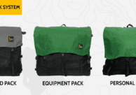
One of the technical ways flatwater canoe trips are packed differently than backpacking trips is in how to organize gear. In a backpacking trip, the gear in the pack often belongs to the person carrying it, with a few communal items like food or shelter divided between party members. The presence of a bulky watercraft to portage…
Is it Spring in Canoe Country Yet?
This winter has felt like a long one. The final weeks before opening water always do, but this year has felt extra drawn out. Numerous cities in Minnesota have broken their snowfall records and ice is still firmly on the lakes around Ely. To the Boundary Waters enthusiast, this is a painful time of year…
The Best Month To Plan A Canoe Trip? Might Be September…
For most of us, the best time to go on a canoe trip is any and every opportunity presented. But if you have a little flexibility in planning your trip, September is a wonderful month to visit canoe country. Here are a few reasons why September might be the best month to plan a wilderness canoe…
The 12 Longest Portages in Canoe Country
The act of portaging between two waterways is usually, understandably, an intentionally short affair. Paddle to the closest point between two water bodies and then portage. This doesn’t make it easy or “type 1 fun” every time, but it’s the burden we bear for wilderness travel. Some portages stick with us whether they are steep…



Hey Riley. You seem very interested in the BWCA history. I have a history project for you if your interested. It’s one I have spent countless hours on. It dates back to the 1930’s. Contact me if you want more info.
Nice story Riley. I’ve always wondered about the fire grates at the BWCA campsites. This was useful information!