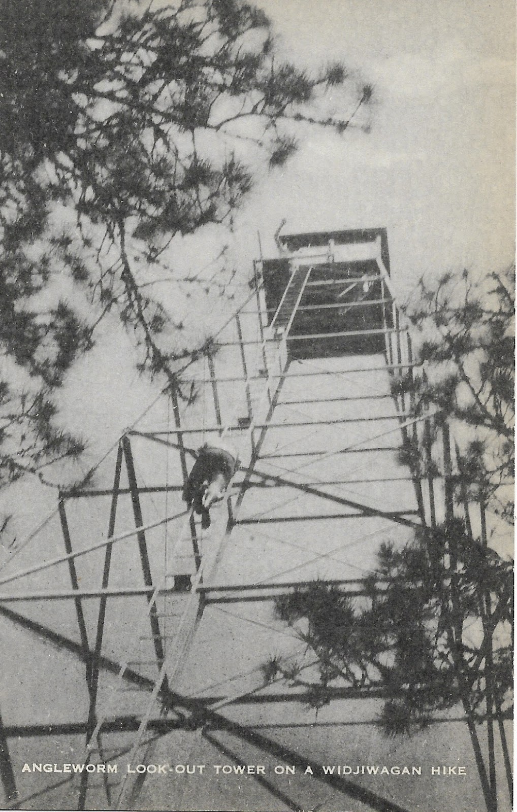
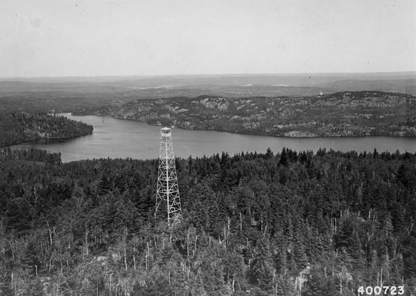
Smoke On the Horizon – How Fire Towers Changed BWCA History

 
Last summer’s drought and subsequent fires were a stark reminder of how wild our northern edge of the state can be. And in the last 15 years as major fires such as Pagami Creek, Ham Lake, Cavity Lake, Greenwood, and others all burned huge swaths of land, many people who live in the northland have turned their attention back to how to predict and prevent wildfires and their paths of destruction. Many of us routinely checked websites such as inciweb to watch as reports come of new fires and the progress of existing ones. These reports are based on the most cutting edge technology the forest service has at their disposal. Gone are the days of Smoky’s “Only You Can Prevent Forest Fires” (changed to a more scientifically-based alternative) and of the watchful rangers manning their towers in search of smoke on the horizon. Where did the lookouts go and how did they shape the experiences of everyone who visits the BWCA?


A drive out from Ely today, and you won’t see many fire towers. They’ve vanished as antiquated methods of dutiful rangers past. But less people remember how those fire towers have shaped our wilderness experiences. Many of the roads and trails into the Boundary Waters once led to fire towers and ranger cabins. For instance, have you ever driven down the Fernberg and hiked off the end of it via the Kekakabic Trail? They used to lead to the Fernberg Lookout and the Kekekabic Lookout beyond. Other old fire towers sat southeast of the Fernberg along lakes whose names you may recognize: Insula, Malberg, and Arrow all had fire towers at one point or another. There used to be a fire tower just south of Ely proper and one by Fenske Lake. Another sat Northwest of Burntside near Slim and another to the west of Big Lake. Angleworm trail was an access route to the Angleworm lookout as was the Sioux Hustler trail to the Sioux River/Cascade tower and the Norway trail to the Norway tower. For many people who visit the Boundary Waters year after year, these fire towers probably are completely unfamiliar to them. So what happened and where did they go?


The story of our local fire towers was like fire towers across the country: times changed. Technology gradually passed the humble fire tower by and slowly, one by one, they were retired and dismantled. Some of the towers deep in the then newly-dubbed BWCA were simply felled where they stood. Their remains still lay quietly concealed in the wilderness today. Others were dismantled and hauled away as scrap while others have been repurposed for different uses. These are some of our local towers’ stories with information borrowed from the Minnesota Firetower Blog, Ken Jackson, and with some updates of what evidence you can still find of them today.


Kekekabic: The Kekekabic Lookout stood high above Kekekabic Lake east of Ely. It was built during the CCC era with steel which was hauled nine lakes in over the ice while concrete and timbers were brought by plane. Eventually, the trail which now bears its name was built from the Fernberg in the west to the Gunflint Lookout near the Gunflint Trail in the east. By all account, the Kekekabic Tower was a popular assignment amongst rangers due to the nearby lake trout fishing. When the towers closed, their access road closed too, though a contentious chapter in local history nearly saw the Kekekabic opened as a driveable route bisecting the new wilderness area. After sitting idle and growing over for some years, the Kekekabic was reopened by a crew of dedicated volunteers as one of the more remote hiking trails in the state with two campsites even voted “the quietest in America” by Backpacker Magazine. As for the tower itself, being one of the more remote of our local lookouts, it never was fully removed. Today, the ranger cabin still is in use at the bottom of the hill by the USFS. The footings for the old tower are easy enough to find, and much of the steel from the tower is discretely hidden not far away.

Kekekabic Lookout

Angleworm: To the west of town along the Echo sits the popular Angleworm Trail. Once upon a time, this trail and portage were a road which ran in toward Angleworm’s southern shore. That road continued past Angleworm towards Fourtown and eventually to the USFS cabin and boathouse near Lower Basswood Falls (the boathouse still stands today.) The old Cloquet Line railway used to run up towards the eastern shore of Angleworm as well. Numerous artifacts from this era are still spread about the forests around the Angleworm Trail. Plenty of the tower remains too. Today, the resounding impact of the tower can be felt in the Angleworm Trail. Many of the hikers likely pass by the old tower and cabin site without a clue of the history hidden nearby. 

Angleworm Lookout

Slim: Unlike Angleworm or Kekekabic, other towers have very little impact on the average recreationalist, but their history is equally fascinating. When most of us think of fire towers, we imagine these soaring steel structures with a small, enclosed cab on top, and many of our local towers were built this way during the CCC era. These towers were actually just the newest generation in a series of towers with some made of steel and others which stood on timbers. The Slim Tower was a graceful if not rudimentary structure with a small “crows nest” type platform perched atop of a slender steel tower. This old tower was made obsolete by larger towers built during the CCC era and, as such, little remains of it. But, as with most manmade structures, a few remnants may be found such as footings and some cabling. And today as folks drive down Van Vac Rd to enter at Slim Lake or explore the north arm ski trails, they pass by this now-empty hill where rangers once dutifully kept watch.
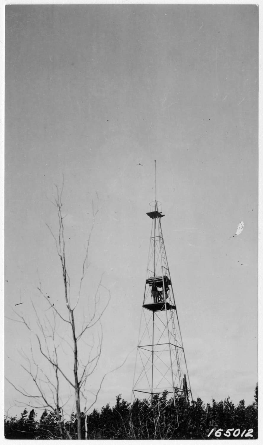
Slim Lake Lookout


Sioux River/Cascade: Little Indian Sioux North is one of the busiest entry points on the Echo Trail and for good reason. The abundant route options and wondrous scenery make for a enjoyable trip. This entry point too was shaped by the fire tower system and the impact still resounds today. This tower went by a couple different names during its service: Sioux River and Cascade. The tower sat on a high point not far from Devil’s Cascade and the current Sioux Hustler trail was part of the access road into the tower and cabin. The cabin sat where the hiking campsite nearest the cascade is today and the tower was a short distance off. As with the rest of the fire towers mentioned here, the Forest Service decommissioned the tower and demolished it. In this case, the cabin went too. Interestingly enough, the cab of the tower remains intact and lay on the ground back in the woods a ways. There is actually a bounty of evidence of this tower and cabin for those with a keen eye. For example, all of the towers were connected to a communication network via telephone lines so rangers could report their observations. While hiking the Sioux Hustler trail to Devil’s Cascade, keep your eyes up towards the old pines. Many of the original anchors are still visible where they have mostly grown into the trees which acted as living, makeshift telephone poles. There’s also plenty of refuse, footings, and even some brick and mortar to be found about. With time though, this evidence of the past is slowly slipping away. Old trails grow over, roads are flooded and washed out, cut over land regrows, and the land is becoming wild again.
 

In these stories of the old fire towers, though the forest is quickly reclaiming its own, we are reminded that this land has a history. And even if the average canoe tripper or backpacker today is completely unaware of it, the signs and stories of the past are still there for the finding. It’s amazing how much our Boundary Waters experience was shaped by the fire tower and ranger cabin network so that even today, fifty years after the the towers began to close, we are still following the same trails and portages cut by the rangers who used them. This little glimpse of history is, itself, a reminder that in every portage and footpath here we follow in the footsteps of the past. Whether these trails were crossed by voyageurs or native peoples, by legendary figures whose names are familiar to us or people lost to history, in venturing here we share in a piece of their legacy. Think of them on your next canoe trip. You never know what stories lay hidden just around the corner.

Sign up for our newsletter to receive updates about new articles, great deals, and information about the activities you love and the gear that makes them possible:


Have You Read Our Other Content?

A Few Tips for Faster Portaging

By mlarson | June 3, 2019

“Anyone who says they like portaging is either a liar or crazy,” said Bill Mason, the legendary Canadian paddler and environmentalist, in his 1984 film Waterwalker.  While there’s a gritty sense of satisfaction in carrying your entire camp over rocks, roots, and trees, for most paddlers portages are something to be completed rather than savored. And…

Map Mondays – Week 4 – Bower Trout to Little Indian Sioux North

By Riley Smith | July 24, 2023

As part of our continuing series on the “route planning game,” we are creating routes using randomly selected entry points, exit points, and number of days to create unique and fun BWCA routes. This week’s randomly selected entry points set us up for a cross-BWCA trip. It’s a long, 10-night trip that covers most of…

How to Name Over 1000 Different Lakes: Part 2

By Riley Smith | October 27, 2023

Last year, we published an article about Boundary Waters lake names, their inspirations, their backgrounds, and which themes and names are common or often repeated. Among 1100 different lakes in the BWCAW alone, there are quite a variety of names! In this sequel article, we are visiting the BWCAW, Quetico, and Voyageurs National Park to…

Gear Features: We’ve got your back(straps)!

By Riley Smith | August 2, 2022

  At Portage North and Sundog Sport, we sell gear that we would want to use and that we can trust. In that pursuit, we are constantly improving our gear so that it can be more enjoyable to use, more trustworthy, and easier to make to a high standard. Much has changed since Portage North…

8 Great Places to Canoe/Kayak Camp this Fall in Minnesota

By Riley Smith | September 29, 2022

Fall is a magical time of the year to get out and enjoy nature. And for me, I think it’s my favorite season to head out in a canoe to relish in the fleeting days of open water. The Boundary Waters are so special this time of year, and next week’s article will cover how…

The Magic of a Winter Wilderness

By Riley Smith | January 25, 2023

The Boundary Waters of northern Minnesota are special. There’s no denying that. Every year, hundreds of thousands flock to this northern wilderness area to experience a landscape where canoes outnumber the cars and a wild landscape is, in some ways, locked in time. But every winter as the canoes are tucked away, the summer tents…

From the Boundary Waters to Superior – How the Water Falls

By Riley Smith | October 27, 2022

The Boundary Waters are one of the premier destinations in Minnesota and across the Midwest, but, as far as water is concerned, the Boundary Waters are not the end of the journey, but the beginning. Most people enthusiastic about the Boundary Waters know that it is divided into two watersheds along an invisible line known…

Is it Spring in Canoe Country Yet?

By Riley Smith | April 28, 2023

This winter has felt like a long one. The final weeks before opening water always do, but this year has felt extra drawn out. Numerous cities in Minnesota have broken their snowfall records and ice is still firmly on the lakes around Ely. To the Boundary Waters enthusiast, this is a painful time of year…

Map Mondays – Week 12 – Little Indian North to Moose River North

By Riley Smith | September 26, 2023

As part of our continuing series on the “route planning game,” we are creating routes using randomly selected entry points, exit points, and number of days to create unique and fun BWCA routes. This route works through parts of the BWCAW’s far western end from the furthest west EP of the BWCA through big lakes…

The Route Planning Game

By Riley Smith | June 15, 2023

“Probably the best remedy for the canoe freak is map watching. Pouring over maps can often get you through the canoeless season when nothing else can. I recommend it highly. If you coat the maps with plastic, you can even use them as tablecloths, curtains, and all sorts of things. However, no matter what you…

Author Bio:

Riley Smith

Riley is the Director of Community Engagement and Public Relations for Portage North and Sundog Sport. He comes from a background in wilderness programing and environmental education with four years of BWCA outfitting and guiding before taking this role. In his free time, he can be found out canoeing, hiking, snowshoeing, capturing photography, and writing.

Leave a Comment