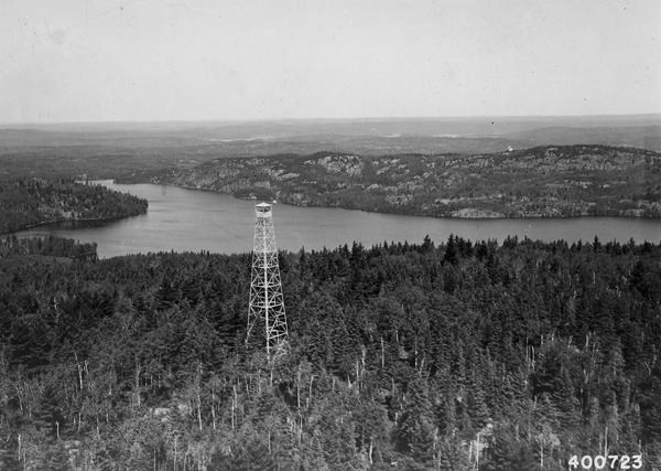
Kekekabic Lookout
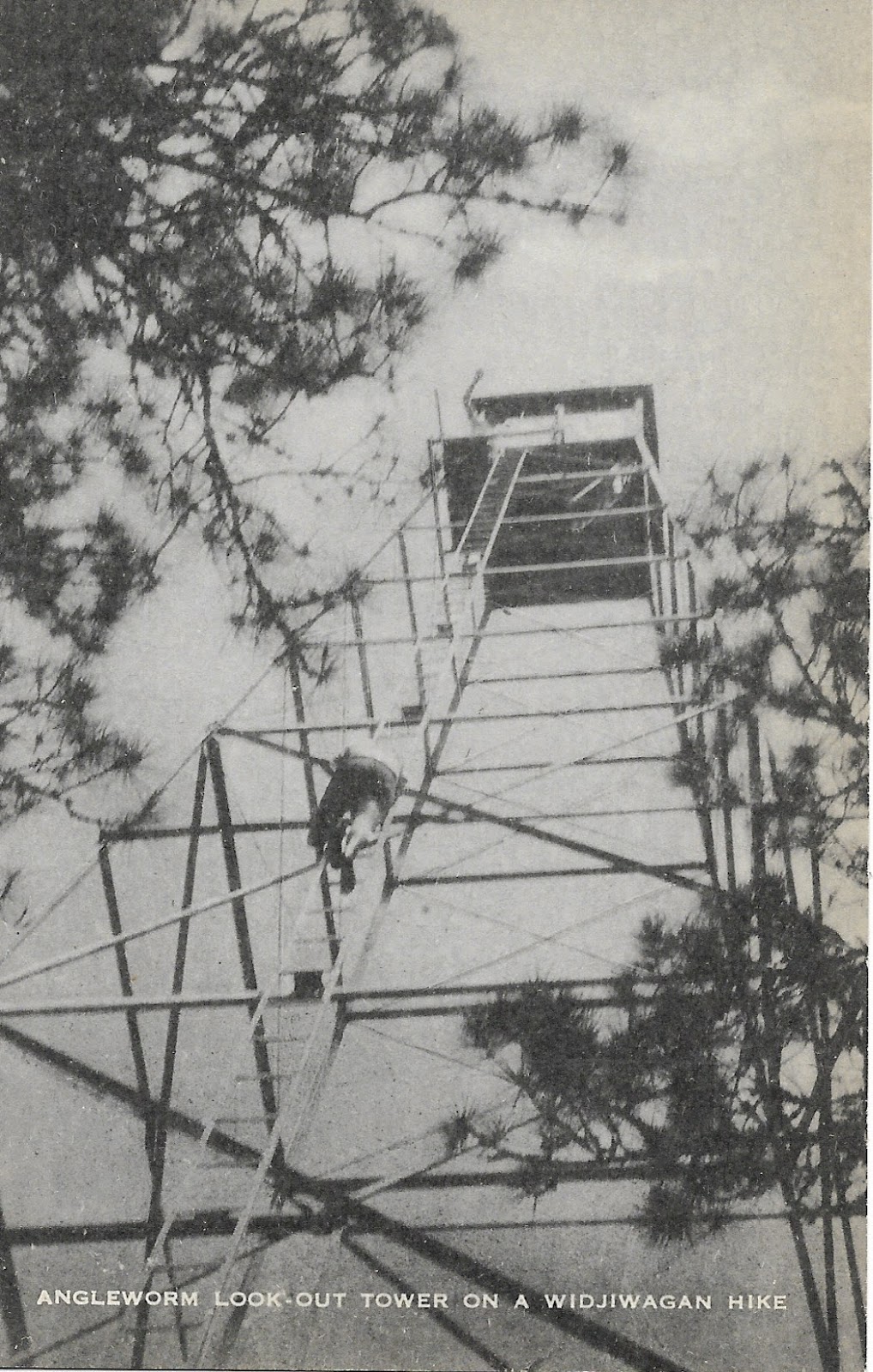
Angleworm Lookout
Slim: Unlike Angleworm or Kekekabic, other towers have very little impact on the average recreationalist, but their history is equally fascinating. When most of us think of fire towers, we imagine these soaring steel structures with a small, enclosed cab on top, and many of our local towers were built this way during the CCC era. These towers were actually just the newest generation in a series of towers with some made of steel and others which stood on timbers. The Slim Tower was a graceful if not rudimentary structure with a small “crows nest” type platform perched atop of a slender steel tower. This old tower was made obsolete by larger towers built during the CCC era and, as such, little remains of it. But, as with most manmade structures, a few remnants may be found such as footings and some cabling. And today as folks drive down Van Vac Rd to enter at Slim Lake or explore the north arm ski trails, they pass by this now-empty hill where rangers once dutifully kept watch.
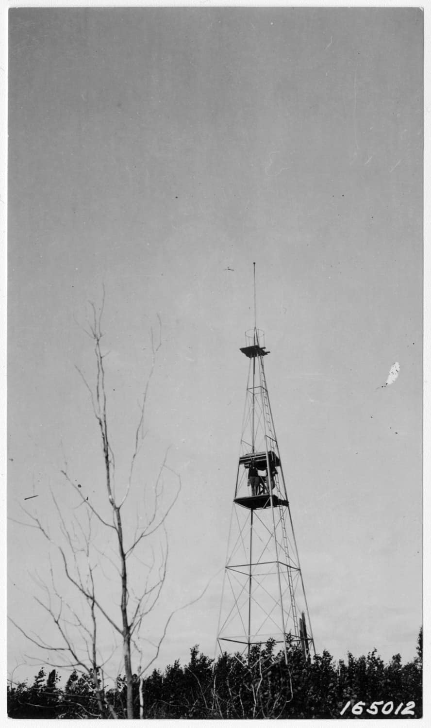
Slim Lake Lookout
In these stories of the old fire towers, though the forest is quickly reclaiming its own, we are reminded that this land has a history. And even if the average canoe tripper or backpacker today is completely unaware of it, the signs and stories of the past are still there for the finding. It’s amazing how much our Boundary Waters experience was shaped by the fire tower and ranger cabin network so that even today, fifty years after the the towers began to close, we are still following the same trails and portages cut by the rangers who used them. This little glimpse of history is, itself, a reminder that in every portage and footpath here we follow in the footsteps of the past. Whether these trails were crossed by voyageurs or native peoples, by legendary figures whose names are familiar to us or people lost to history, in venturing here we share in a piece of their legacy. Think of them on your next canoe trip. You never know what stories lay hidden just around the corner.

Sign up for our newsletter to receive updates about new articles, great deals, and information about the activities you love and the gear that makes them possible:
Have You Read Our Other Content?

Finding Solitude in the BWCAW
Though the Boundary Waters is the most visited wilderness area in the United States, it’s refreshingly empty compared to most national or state parks and seldom feels crowded. For many, the occasional encounter with another group is no big deal. But all of us dream about wilderness solitude at some point in our outdoor career:…

How to Plan a BWCA Route: The Treebear Way
Amidst guiding, outfitting, and plenty of personal trips in between, I’m blessed to have “crossed the line” into the BWCA 88 different times. I look back at all those incredible memories and know beyond a shadow of a doubt that the Boundary Waters still has plenty of surprises in store and so many more breathtaking moments to come. I also believe I…

10 Steps in Planning an October Canoe Trip to the BWCA
Fall is a magical season in canoe country: a brief respite of quiet calm between the relative chaos of summer and the icy grip of winter. And, in many ways, the experience of a canoe trip in the BWCA is greatly enriched by the season. Once October 1st rolls around though, the looming threat of…
")
A Week in January – A Winter Trip Report
The week we had looked forward to had come around again: the Week of Winter annual BWCA trip. This tradition is relatively new, last year was our first, but it seems poised to be a trip that continues annually. January is a fascinating time to take a week long BWCA trip both because winter…

Emergency Communication in the Wilderness – 4 Things To Know Before Your Canoe Trip
If you’ve never been on a wilderness trip before, the idea of traveling beyond cell service, seemingly out of touch with the rest of the world, can seem daunting. The questions are many: How do we let concerned family members know where we are? Will there be any cell service? What if we need to…

The Route Planning Game
“Probably the best remedy for the canoe freak is map watching. Pouring over maps can often get you through the canoeless season when nothing else can. I recommend it highly. If you coat the maps with plastic, you can even use them as tablecloths, curtains, and all sorts of things. However, no matter what you…

Is it Possible to Circumnavigate Minnesota by Canoe?
Preface: This route plan should not be utilized without extensive personal research. I have not completed this route nor do I specifically intend to. It exists for entertainment purposes only. As with all adventures, do your due diligence and research in vetting any part of this article before attempting a dangerous or challenging activity. With…

How Trees Tell the Story of the BWCA
Today is the International Day of Forests which means it’s the perfect day to celebrate the trees of the BWCA. The Boundary Waters are a unique mosaic of forests born out of wildfire, windstorms, logging, and the passage of time. Despite the history of disturbance, the Boundary Waters contain the largest tracts of old growth…

Map Mondays – Week 12 – Little Indian North to Moose River North
As part of our continuing series on the “route planning game,” we are creating routes using randomly selected entry points, exit points, and number of days to create unique and fun BWCA routes. This route works through parts of the BWCAW’s far western end from the furthest west EP of the BWCA through big lakes…

Map Mondays – Week 8 – South Kawishiwi to Moose Lake
As part of our continuing series on the “route planning game,” we are creating routes using randomly selected entry points, exit points, and number of days to create unique and fun BWCA routes. Let’s check it out! Total Mileage: 51 milesNights: 4Paddle Distance: 46.7 milesPortage Distance: 4.4 miles Day 1: Miles: 9.4Target Campsite: Kawishiwi River…