The Boundary Waters have always been steeped in discussions of how to manage the number of people who visit it. Unlike western wildernesses, there is no natural filter which prevents large numbers of visitors from enjoying it. Many wilderness areas are remote, buffered by dozens of miles of existing land that one must travel through to reach the wilderness area. The Boundary Waters is not limited by one’s ability to access, at least during the summer. Other wilderness areas require a person to have specialized skills to overcome altitude, water crossings, or extreme terrain in order to gain passage into the wilderness. The Boundary Waters also doesn’t have that. And so, with the intent of limiting and dispersing visitors, the entry point quota system was born. The entry point lakes themselves have each gained acclaim and followings and each person who has garnered life-long affinities for the BWCA has their favorites. There are entry points for canoeing long distances, there are entry points for base camping, there are entry points with lots of other groups, there are entry points where your group is the only one for the next two days, there are entry points for hiking, skiing, and motor boating and on and on it goes. Each sets visitors up for a unique experience wherever they find themselves around the boundary of the Boundary Waters. But this brings me to a niche study of history that I have been exploring for a few years: where have the old entry points gone? When one looks at the entry point list online (something many of us will be doing with great intent in a couple months time), each entry point name is accompanied by a number (Entry Point 1 – Trout Lake, Entry Point 4 – Crab/Cummings, Entry Point 6 – Slim Lake, and so on.) An astute observer will note that, though the numbers rise all the way to 80s on the website, there quite a few numbers missing in between. So where did those entry points go? The stories are intriguing as the history of the BWCA itself.
First off, it’s important to point out that the entry point system doesn’t actually stop at Entry Point 86 – Pow Wow Trail. Many of the ski entry points are assigned numbers too. Since these are not intended for summertime overnight traffic, they don’t find their way onto the website. Entry points such as North Arm Trails, Farm Lake Trails, Flour Lake, Topper Lake, Banadad, and others have numbers in the 90s. However, those entry points simply have a sign and a permit box for winter travel which doesn’t have the quotas imposed between May and October. Many of the upper numbers in the online-reservable EPs are hiking trails or late-addition entry points such as Larch Creek or Snake River which were added later as small alternative entry points.
Now for the missing ones. Some of the missing BWCA entry points owe back to changes in BWCA boundaries and access roads. Much of this change came after the 1978 BWCA act which added land to the wilderness and banned logging. Removing logging from the wilderness also meant old roads were closed or left unmaintained. This impacted a number of entry points. Entry Point 2 – Phantom Lake was phased out after the old logging roads used to access it were closed down. These logging roads are still quite clear and can be seen snaking through most of the western section of the BWCA. The chain of lakes around Phantom is now accessed from EP 4 – Crab Lake/Cummings Lake from Burntside. Entry Point 21 (now Angleworm Trail) formerly was Fourtown Lake, 22 (now Mudro – Restricted) was Horse Lake, and 23 (now Mudro) was the Range River. These boundaries were shifted around with the ’78 BWCA act and access to Range Lake dwindled with the decline of the old Cloquet Line. The closing and redistribution of these EPs changed how traffic flowed through these areas as well as leaving behind some old portages and campsites which feel out of the way today.
Others entry points were removed as regulations evolved over time. Entry Point 63 was closed in the 90s. Many entry point closures were suggested amide overuse discussions. A large panel of cooperators discussed with the forest service permit reductions, entry point reductions, and a shift in the total number of people allowed per permit from 10 to 9. In the end, some changes were made but the entry points themselves were mostly left alone. However Entry Point 63 – Four Mile Portage, was closed. Since the closure of the truck portage, the Four Mile saw a steep drop in usage. By the time of the regulations discussion, it was seen as redundant as holders of a Fall Lake permit could still use the Four Mile if they chose.
These are the only missing entry points I really know. Most of the remainder are an enduring mystery. I wasn’t there and I haven’t heard the stories, but someone was and did. And so I keep looking because in learning the stories of these old entry points I can continue to understand the decisions which shape this wilderness area today. Here are some of the mysteries:
Entry Point 3 was the old Pine Lake Trail off of Bear Creek near Vermillion. At some point it vanished and I haven’t heard an infallible reason why. Other low-usage hiking EPs remain such as Norway (EP -10) and Blandin (EP – 11) for example, so why EP 3 closed seems odd. I would love to hear stories about this one. I heard somewhere that an old trapper used it as an off season short cut to Pine, but I haven’t heard its history as an entry point and why it was closed.
EP 5 I have never found a conclusive location for. Likely somewhere west side though as that is where it would make sense. Something like Bear Creek would make sense as an EP since it is a mostly navigable waterway which leads into the BWCA and had a campsite at one point. However, it’s in the wrong spot for entry point numbers to be concurrent.
Entry Point 17 I guessed was the Portage River which now shares an EP with 16, I do not know this for a fact. Both were popular routes before the Echo Trail and both were access points for the area which is now the BWCA. They both technically are on the permit for EP 16, though the Portage is no longer maintained. Perhaps when it was a more common route it had its own permit or perhaps a route I am completely unaware of was an entry point? I guess I have to keep digging.
I also guessed EP 18 was the Stuart River/LLC trail which formerly ran to Stuart Lake and the ranger cabin on LLC. The picture from the header is from Mule Lake which sits along the old trail. At one time, it was built as one of two roads splitting off from an old gravel pit along the Echo. The Forest Service really closed these roads to keep atv’s from driving back into the wilderness. At one time, roads ran to most of the forest service cabins throughout the wilderness (Lower Basswood, LLC, Little Indian Sioux, Kekekabic, Brule Lake Trail, and so on.) Many were closed after motor usage ceased and the fire towers were demolished (see our previous article on fire towers.) Some reopened for use as hiking trails, but, despite willing volunteers, the old LLC trail was forbidden to be reopened. I theorize that EP 18 used to be assigned to it. Again though, that’s just a running theory. I would love to hear more!
Entry Point 46 would make sense somewhere near the Poplar/Lima Grade area. I guessed that it had something to do with the Brule River which once had maintained portages into Vista, but with the number of combined EPs attached to Poplar there are many options to be found.
Entry Point 53 I heard rumor had something to do with Seagull. I have never heard any more than just that rumor.
Entry Point 65, 72, and 73 are big question marks I have never even found a lead on.
And that leaves 85 which I always believed to be the Eastern Loop of the Pow Wow Trail. The eastern loop declined in the 80s and was eventually enveloped into the new PMA system which negated trail maintenance. Pagami Creek fire erased what little remained. However, it was a hiking trail and entry point 86 is the western half so it does make sense that 85 would be eastern. However, I have never had 100% confirmation of this theory.
It’s the sleuthing and the enduring mystery that makes this study fascinating. Just as I have my favorite entry points I tend to return to again and again, someone enjoyed these lost entry points. But where did they go and when? Someone has the stories. And to me, it’s pretty intriguing to look at the Recreation.gov site and see these gaps in the existing permits and imagine that each gap in the numbers represents a place where people canoed, hiked, set off grouse hunting, or went to get away. This place is always changing and management decisions, permits, and entry points are all a part of it. And so I’ll keep listening to stories and following up rumors because I appreciate understanding this piece of history. Where did the lost entry points go? Perhaps this article provides a few answers and can inspire you to reminisce and share your stories about past adventures. And as always, if you know some of these gaps in the entry points, I would love to hear some of your stories too.
Sign up for our newsletter to receive updates about new articles, great deals, and information about the activities you love and the gear that makes them possible:
Have You Read Our Other Content?
Upward, upward: Which portage is the tip top?
What is the most difficult portage in the BWCA? This is an impossible question to answer. Is it the steepest? How about the longest? How about the one that has the most mud, the most bugs, the slipperiest rocks, or the worst landing? In truth, the most difficult portage is an entirely subjective question bent…
How to Plan a BWCA Route: The Treebear Way
Amidst guiding, outfitting, and plenty of personal trips in between, I’m blessed to have “crossed the line” into the BWCA 88 different times. I look back at all those incredible memories and know beyond a shadow of a doubt that the Boundary Waters still has plenty of surprises in store and so many more breathtaking moments to come. I also believe I…
Gear Features: We’ve got your back(straps)!
At Portage North and Sundog Sport, we sell gear that we would want to use and that we can trust. In that pursuit, we are constantly improving our gear so that it can be more enjoyable to use, more trustworthy, and easier to make to a high standard. Much has changed since Portage North…
Five Ways to Make the Most of BWCA Permit Day
With BWCA permit day just around the corner, plenty of people are waiting in eager anticipation of how opening day will set the trajectory of their summer trips. Some people will log on the moment that permits open to try to reserve a premium entry point on the dates that they are available to go.…
A Fire Perspective: 200 Years of Wildfires
Few natural processes inspire the fear and awe that wildfires do. In nature, fire is a seeming paradox of death and new life. Gigantic, swirling infernos that engulf the landscape in an unheeding wall of flame become landscape-level scars healed by green shoots and wildflowers. And here on the southern edge of the boreal forest,…
Map Mondays – Week 3 – Crab Lake/Cummings Lake to Big Lake
As part of our continuing series on the “route planning game,” we are creating routes using randomly selected entry points, exit points, and number of days to create unique and fun BWCA routes. This week is an arduous 6 night trip through the far western reaches of the BWCA. This area of the BWCA can…
Is it Possible to Circumnavigate Minnesota by Canoe?
Preface: This route plan should not be utilized without extensive personal research. I have not completed this route nor do I specifically intend to. It exists for entertainment purposes only. As with all adventures, do your due diligence and research in vetting any part of this article before attempting a dangerous or challenging activity. With…
An Expert’s Perspective on BWCA Forests
Lee Frelich, Director of The University of Minnesota Center for Forest Ecology, is one of the foremost experts on the forests of the BWCAW and the fire ecology that dictates its composition. We interviewed him to gain his invaluable insight into this incredible ecosystem, its history, and a glimpse into its future. Question 1. For…




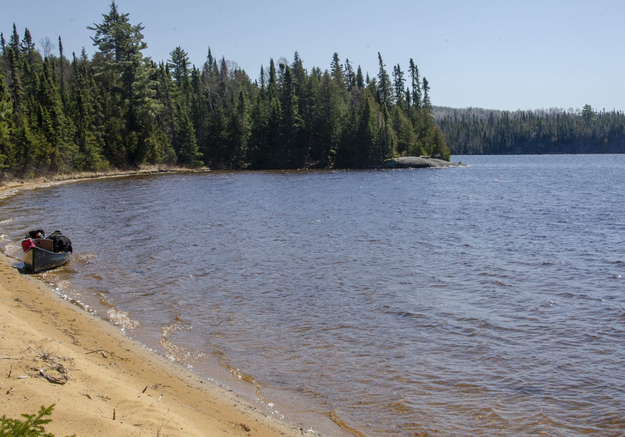

When the LLC was still open, I did it over a dozen times in the 80/90 time period. A few years ago I ws able to retrace it all the way back to the river and Stuart Lake. It’s to bad this trail has been closed as the fishing was pretty good at Stuart Lake. I would be interested to know when that picture of Mule Lake was taken. As the trail, what’s left of it, does not close to Mule. I recall years ago your view of Mule as we made it our halfway stop on trips
And you are likely one of few people who knows that view of Mule! Well done. That photo is from 2022 when I found my way back there. I didn’t have the time to try to follow it further, but I hope to someday. Thanks for reading.